Inventory
Plant inventories of the permanent (five-year cycle) and nursery collections (annual) undergo continual refinement and are a primary means of collections control. Inventory observations are housed in BG-BASE, the institution’s plant database of record, and may include: phenological stage, performance, unique ornamental characteristics, growth and survival rates, hardiness potential, specific propagation techniques, a botanical description, and taxonomic verifications. Additional notations may document storm damage, susceptibility to insects or diseases, or experimental data. Inventory methodologies are detailed in the Arboretum’s Plant Inventory Operations Manual.
Labels
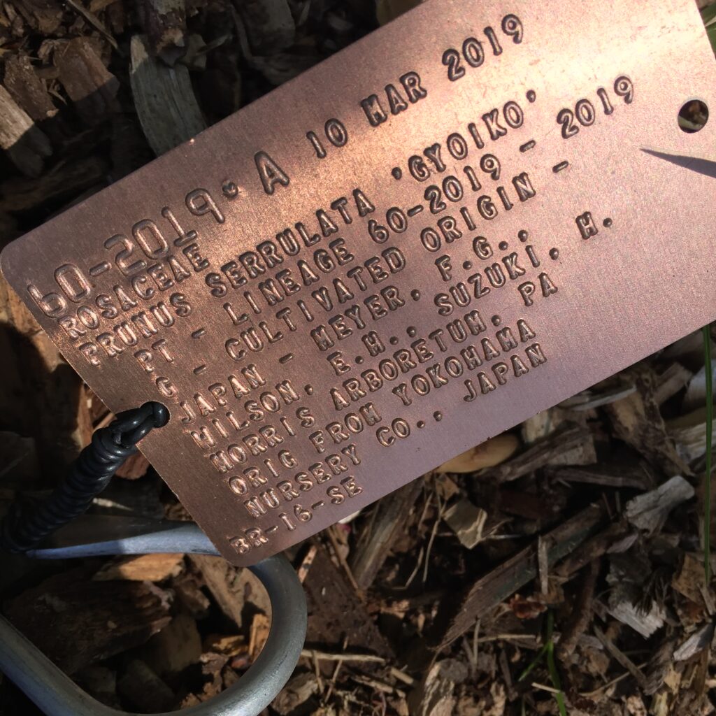
Plants in the collections hold anodized aluminum records labels that provide accession number, letter qualifier (denoting individuals of an accession), accession date, family, botanical name, propagule type (e.g., SD [seed], CT [cutting], PT [plant], GR [graft]), lineage number and year, provenance type (e.g., G [garden or cultivated origin], W [wild origin], Z [cultivated plant of known (indirect) wild origin], or U [unknown origin]) and source, common name, and Arboretum grounds location. Each records label is embossed in-house using a CIM Maxima 841 metal card machine.
In addition to records labels, two types of display labels aid in interpreting Arboretum collections. The first and most ubiquitous are trunk labels that provide common and scientific names, nativity, and the botanical family to which the genus belongs. New trunk labels bear the afore mentioned information along with an accession number, year of accession, and hybrid parentage. The second are stake labels which are positioned in front of plants in Azalea Border, Bonsai & Penjing Collection, Bradley Rosaceous Collection, Explorers Garden, Leventritt Shrub & Vine Garden, Wolcott Bed, and Weld Hill/Hunnewell Building areas. Stake labels provide scientific and common names, hybrid parentage, nativity, Arnold Arboretum introduction phraseology, and botanical family information.
A label standards and source guide, can be found in our Plant Inventory Operations Manual, Appendix I.
Mapping
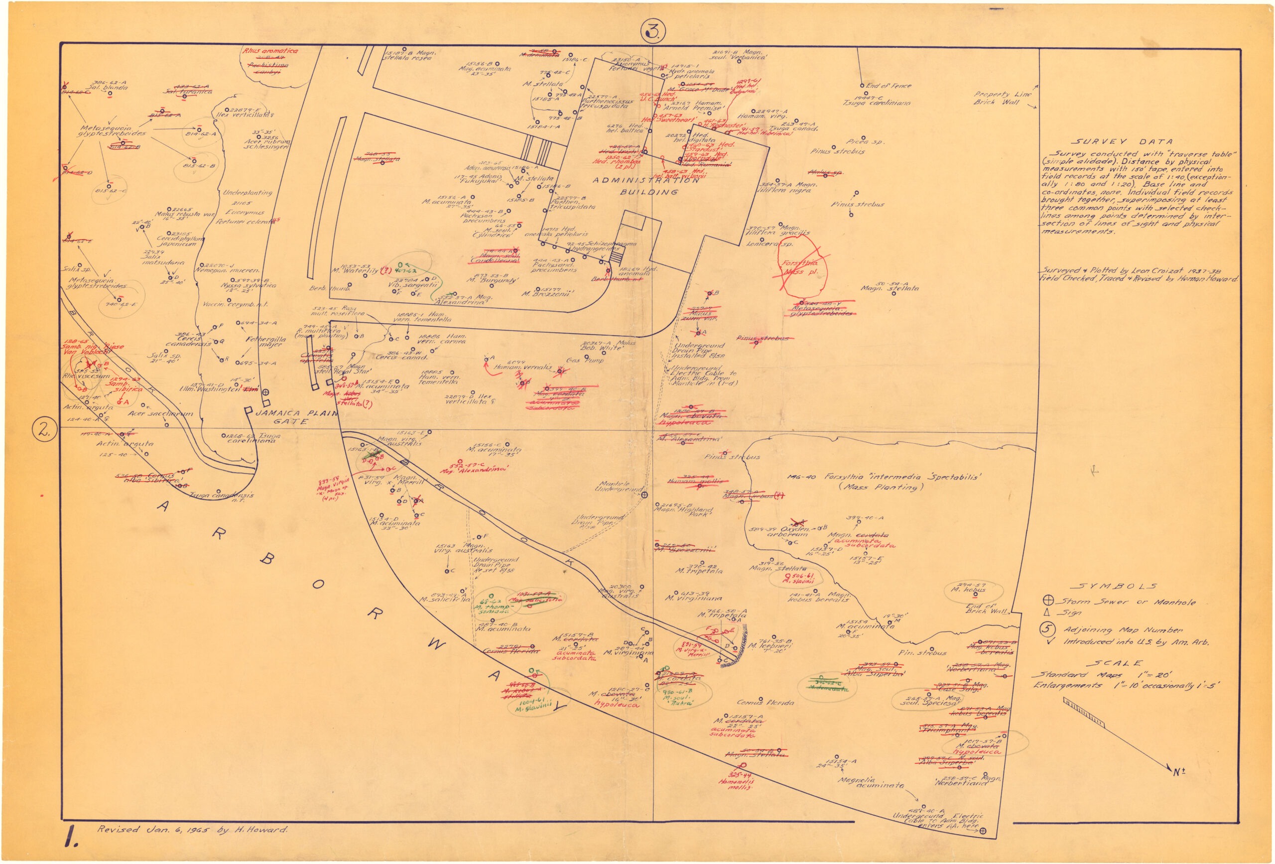
The Arboretum utilizes the ESRI software suite to manage, analyze, query, capture, manipulate, and display geographic information. Decimeter accurate field mapping of landscape features (e.g. plants) is accomplished using a Trimble TDC6 data collector and R580 GNSS antenna.
Locations within the Arboretum are defined by a grid overlaid onto a base map that divides the property into 77 individual maps, each 400 feet by 600 feet. Each map is further divided into 4 quadrants (200 feet by 300 feet) labeled NW, NE, SW, SE. Plant beds within named garden areas (e.g., Explorers Garden, Bradley Rosaceous Collection, Leventritt Shrub & Vine Garden) are given their own location designations. Taken together, these locations aid researchers and visitors in locating plants in the collections. Plant locations are made available through our searchable plant inventory, interactive map, and records labels.
Delve deeper into GIS at the Arboretum.
Contact Us
Learn more about curatorial support of research investigations and the availability of propagation materials. We look forward to your visit.