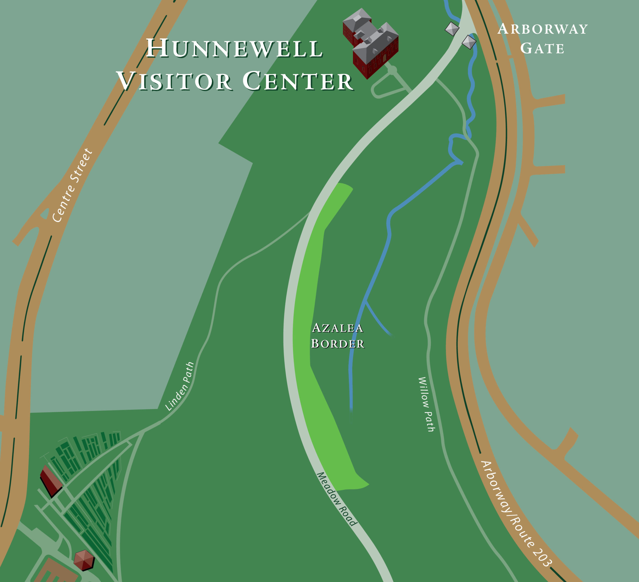
Directions
From the Arborway Gate, Azalea Border is about a five minute walk; it is about 10 minutes from the Forest Hills Gate and about twenty-five minutes from the Bussey Street Gate. Azalea Border is on the eastern side of Meadow Road. Its northern edge is opposite the intersection of Linden Path and Meadow Road; the southern edge of the Border is near the Maple Collection. If driving, park along the Arborway.
Accessibility
Azalea Border is adjacent to Meadow Road, which is paved and fully accessible.
Interpretation
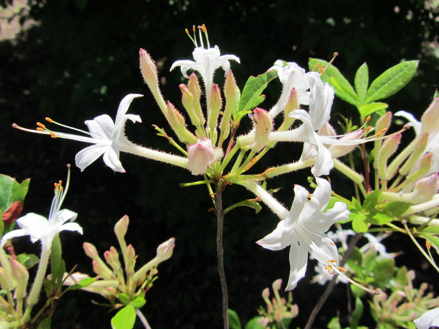
Download a tour brochure for azaleas [pdf].
You can also view this tour on the Arboretum Explorer interative map. Follow this link and you will see colored leaf icons. Click/tap on an icon to get a plant name and image; click/tap the “i” button on the right to get more detailed information. For more information on how to use the mobile application click/tap on “Help” in the menu.
How long should I explore?
Spend five to ten minutes walking by Azalea Border, or longer in spring when the varied collections are in bloom.
Plan your visit to the Arboretum.